Composed of the words sliding and knowing, the norwegian term ‘skyvelære’ means caliper, a device for measuring distance. In Skyvelære, Ellen Røed is reflecting on devices and procedures that are used in video art and in the natural sciences. She considers various relationships involved in creating representations; field trips, story telling, gathering or capturing of data, measuring, calibrating.
The exhibition Skyvelære #1 (Callipers) at Kunsthall 3,14 in 2013 was Ellen Røed’s final PhD project at Bergen National Academy of Arts and Design. Røed collaborated with the artist Signe Lidén on two of the installations in the exhibition. The exhibition was supported by Norwegian Artistic Research Fellowship Programme, Bergen National Academy of Art and Design, Bergen Municipality and BEK.
Excerpt from video (5:31 min.)
Skyvelære #1
By Ellen Røed
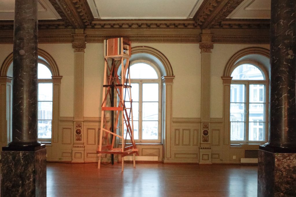
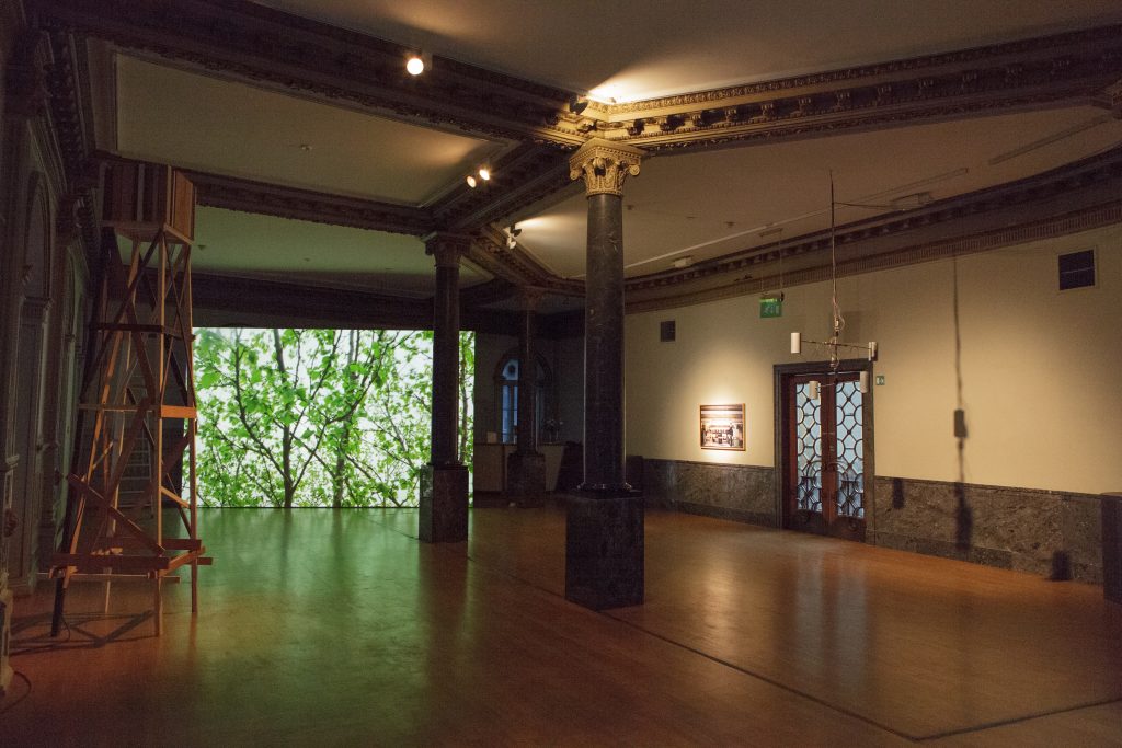
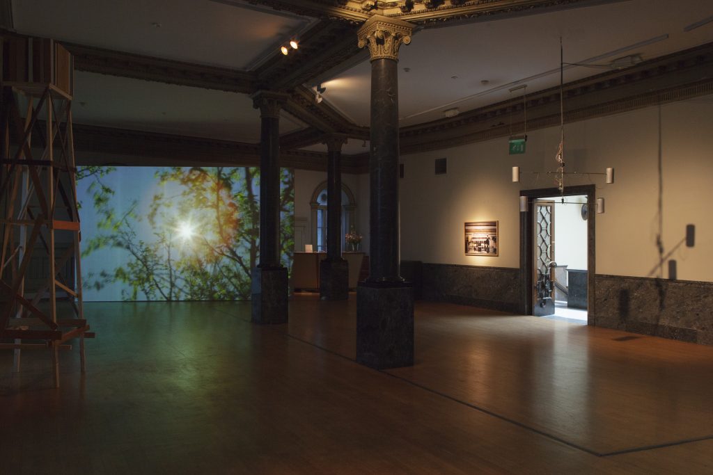
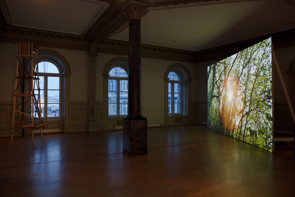
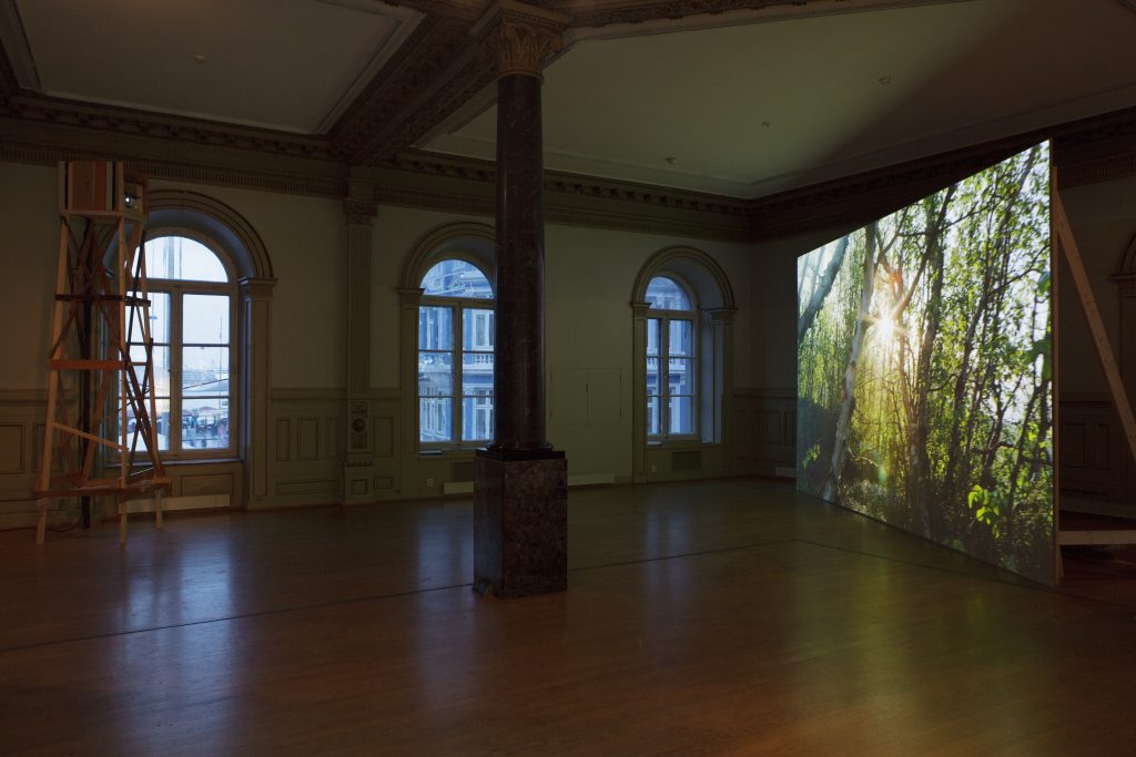
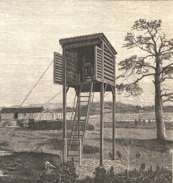
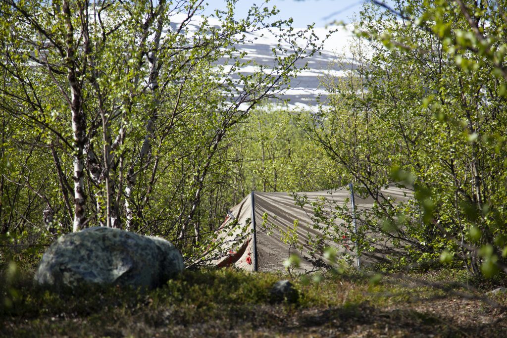
Upon entering the exhibition, slightly off the dominating central axis, a wooden tower is seen at the opposite side of the room. It functions both as a sculptural element and as a projector stand, a device or tool within the exhibition, in the same way as a similar tower would have done on the outside for a hunter or scientist engaging with the natural environment. The tower is shaped in a way that imitates the towers bird-watchers or hunters build as observation posts in the landscape. It is constructed from found material with a small hut-like platform on top. It is also reminiscent of a weather hut that scientists might build to place various instruments on for measuring the wind, temperature or the magnetic field of the Earth.
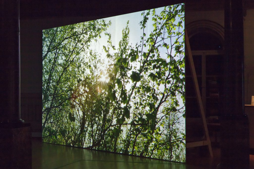
Rather than supporting telescopes, thermometers or other observational probes, the tower supports a video projector projecting a moving image of a landscape onto an angled wall, seven metres from the tower. The wall is entirely covered by the projection in a way that makes it appear to be a freestanding image. It also functions as scenography, constituting a temporary fond wall, leaving open space in front of it.
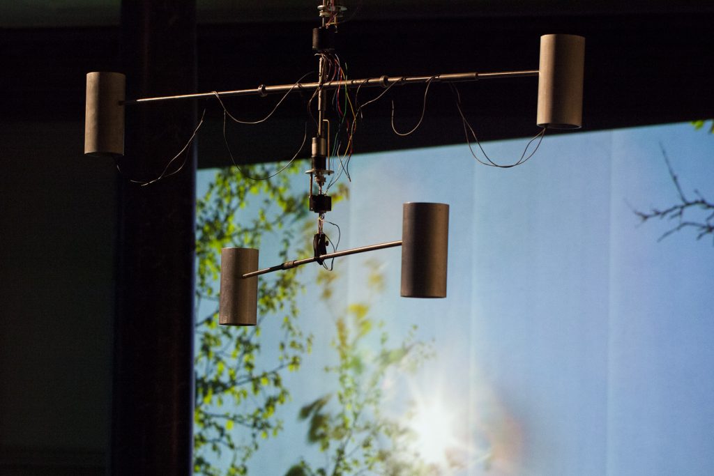
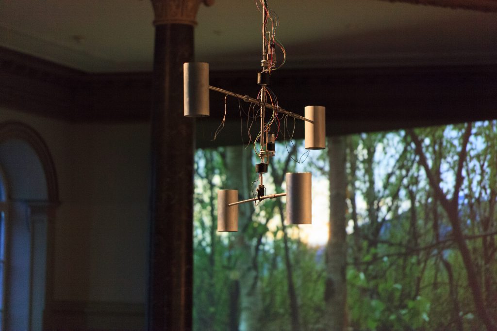
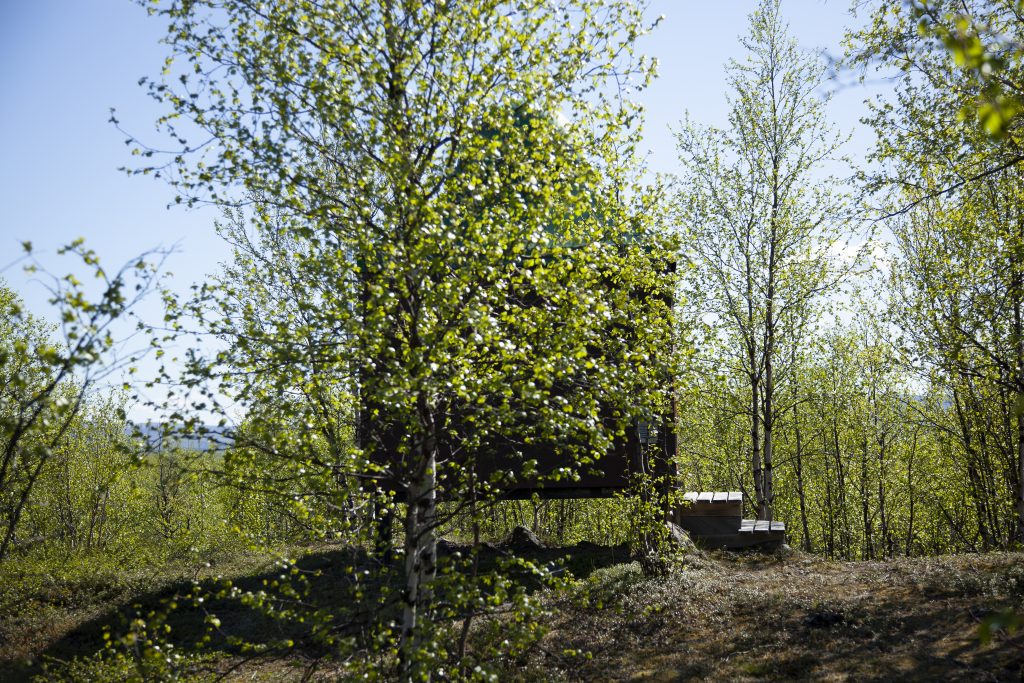
The projected image is a sequence of photographs taken in June 2012, as part of fieldwork on the Swedish subarctic tundra. Throughout the projected sequence, the sun remains in the centre of the image, while birch trees, mountains and clouds pan by. The camera appears to have remained fixed in a specific point in the landscape, while the Earth rotated around the sun in three continuous cycles. There is no sound connected to this installation, but the ambient sounds emitting from the kinetic sculpture are vaguely present.
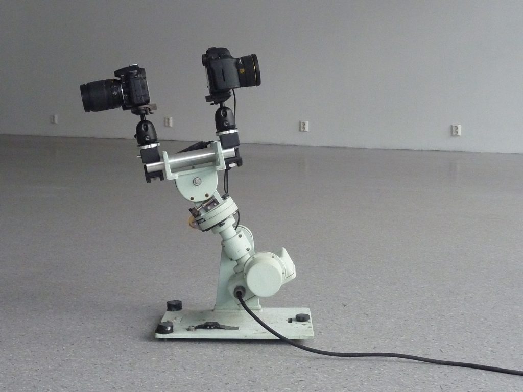
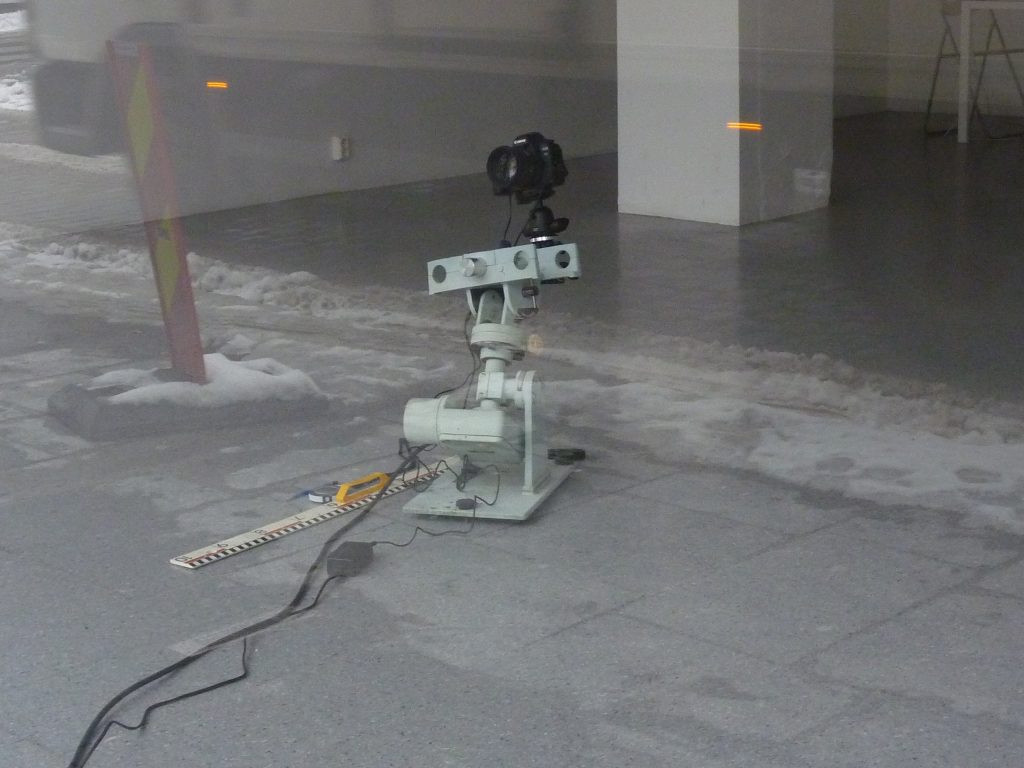
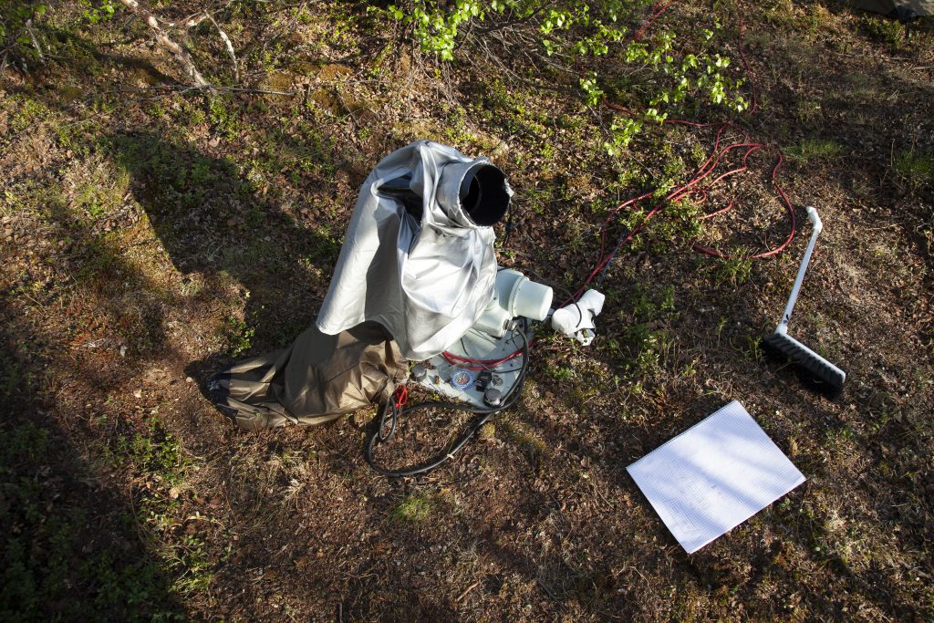
The sequence was made using asolar tracker that compensates for the rotation of the Earth and remains pointed towards the Sun as its position changes through the day and night. It was an EppleyST-1, a model of equatorial solar trackers designed and constructed in the 1960s at the Eppley Laboratory. I took a photo every ten seconds for several days. Seventy-two hours are represented in the projected sequence, repeating the same path in the landscape three times over in continuously shifting weather conditions. The photos are played back chronologically at 25 images per second as a time-lapse film lasting about 20 minutes, repeated in a loop.
This far north, the sun does not set in June. It is the period of the midnight sun, and the sun is visible 24 hours a day, unless it is hidden behind clouds, mountains or trees. This is reflected in the sequence. The sun glows and flickers, becomes paler as clouds fill the sky, and disappears and re-appears from behind leaves, mountains or clouds that pass by. The camera never points below the horizon, but the landscape tilts up and down according to how high or low in the sky the sun is. The movement stutters slightly and there is some flickering due to various small changes between the images. The sun is mostly located in the centre of the image.
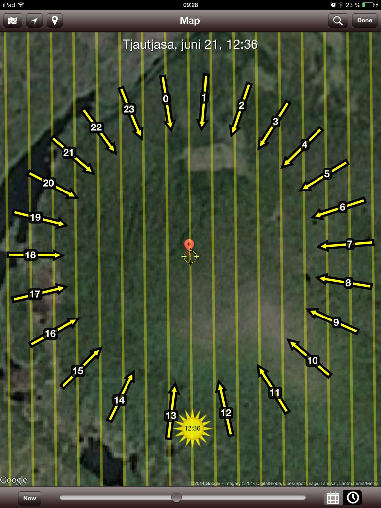
The ST-1 requires manual calibration, which involves repeated repositioning depending on the actual position of the Sun (cardinal direction, vertical angle), its own position (longitude, latitude, cardinal direction) and true solar time, which must be calculated according to a formula. The photos were taken during such a navigating and aligning procedure. In the sequence, the sun occasionally drifts off from its ideal position, in this case in the centre of the image, revealing that further calibration is necessary. It is soon pulled back to its ideal position.
Because of the geographical position and time of the year, there were rapid changes in the inclination of the sun, causing calibration difficulties that are reflected in the corresponding images. The position was verified and adjusted every hour. Also, while the shutter speed was mostly kept at six to eight seconds, other parameters of the digital camera were manually tweaked on an ongoing basis in response to fluctuations in the amount of light. A cloud passing in front of the sun required the shutter speed and ISO to be changed, and this produced deviating images that interrupted the impression of continuity in the sequence. During the evening, night, and morning the changes in light made it necessary to adjust the camera every twenty to thirty minutes, and less frequently during the day depending on cloud formations.
The technique applied here, time-lapse, consists of a sequence of photos taken at a certain interval, in this case 10 seconds, and presented at a reduced interval, 1/25 seconds. Since the time span between each photo is reduced, the procedure can capture processes that evolve so slowly that they are hardly perceptible, and represent them as a continual movement, thus revealing slow change. Time-lapse photography often involves an automated procedure, while calibration is one of the procedures of the natural sciences that still has to be performed manually. There nevertheless seems to be a close relationship between the two. Calibration is a measure that ensures compatibility, so that sequences of captured data, such as photographs, can be compared. Calibration involves defining a reference, an ideal. Between this ideal and the realities of practice, a form of tuning goes on that activates the relationship between the ideal and practice and makes it reflexive.
Time-lapse photography evolved in the second half of the 19th century, a period marked by a rich and complex web of developments in science and technology, through advances in photographic techniques that could capture and render motion in a sequence of images. In 1895, the Lumière brothers patented their cinematographic camera, which could capture and project moving images. However, cinema was not a single invention that can be traced through a linear history. Twenty years earlier, a device for sequential photography was invented by an astronomer, Jules Janssen, in order to photograph Venus passing in front of the sun. During the transit of Venus in 1874, Janssen captured a sequence of photographs. Projected sequentially, as a time-lapse, these pictures captured the slow movement of Venus as it punctured the edge of the solar disc (Janssen, 1874). Janssen’s method was improved by Eadweard Muybridge, who at first captured sequences of animals in motion in order to do the opposite, i.e. to capture movement and study it as sequential steps (Muybridge, 1877). Time-lapse films based on microscopic images of microbes and other organisms invisible to the human eye were first produced in 1909 by Jean Comandon at the Pasteur Institute in collaboration with the Pathé brothers, who had acquired the Lumière brothers’ patents (Comandon, 1909). The Oxford Scientific Film Institute, founded in 1968, still specialises in time-lapse and slow-motion systems, and it has developed camera systems that can enter and move through impossibly small places (Williams, 2011).
Two passages of Venus in front of the sun, first in December 1874 and again in December 1882, made the sun the target motif for a number of expeditions collecting scientific evidence through photography. These transits offered a new possibility to calculate the solar parallax and thereby determine the scale of the universe. The parallax had been calculated on a number of expeditions during the previous transit, in 1769, for example by the astronomer Maximilian Hell in Vardø, but there were many controversies concerning the results, all of which were slightly different (Much later, the observations and calculations of Maximilian Hell were proved to be almost exactly correct). Photography seemed to offer the level of precision and comparability of data that were necessary to produce a uniform representation of the movement of Venus in front of the Sun, so astronomers devised new instruments and techniques of solar photography in preparation for the first transit. However, as Canales describes in A Tenth of a Second (Canales, 2009), soon after the first transit the astronomers acknowledged that the resulting pictures were so different from each other that they were incomparable. This was partly attributed to the fact that most observers had used different devices, many of them self -invented, that imprinted themselves accordingly on the captured data (the photographs).
Differences between sets of data, one of the biggest challenges in scientific measuring, were not unusual in themselves. Astronomers making simultaneous observations of planetary transits from the same place would systematically record slightly different values. Such differences were attributed to a number of factors, ranging from personal aspects of the observation, such as lack of sleep on the observer’s part, to more technical circumstances, such as the apparatus or the inclination of the object observed, which would in turn influence the body of the observer and even his psychic state (Sanford, 1889). The astronomy community was hoping that photography might provide a solution to the problem, since it had the potential to move the source of the evidential astronomical material from the astronomer to the sun itself. This could solve the problem of standardisation and enable the collected evidence, or data, to be comparable. They also invented the personal equation, mathematical equations applied to the observational data of each astronomer/device, as a way of counteracting some of the individual differences between astronomers’ data.
In the end, it turned out that the photos from each observer/photographer were anything but uniform, and photography revealed itself to be an imprecise and unreliable method for gathering scientific evidence. Astronomically, and for the task at hand, the data Janssen had captured with his photo-revolver were considered worthless. In 1881, a conference held in preparation for the second transit concluded, on the basis of the experience from 1874, that direct observations were better than photographic ones (Canales, 2009). By 1882, almost every astronomer recognised that, when planning the 1874 transit expeditions, they should have ‘agreed on the type of instruments and adopted everywhere the same dimensions in order to render observations more comparable‘. (Conference Internationale du Passage de Venus, 1881, cited by Canales). Following these events, astronomers used drawing as a way of collecting evidence of the subsequent 1881 transit, and, from then on, cinema and science evolved along diverging trajectories. Time-lapse photography nevertheless became an important device in science because of its ability to reveal change occurring in slow processes.
Transits of Venus, when the planet Venus appears as a small, dark disk moving across the surface of the sun, are among the rarest of predictable celestial phenomena. They occur in pairs, eight years apart. while more than a century elapses from one pair to the next. In June 2004, the first transit of the pair following the one in 1881 was photographed by artist Wolfgang Tillmans from the attic of his studio. The photos are considered to be among his best and have clearly influenced his practice. In Truth Study Centre, a printed collection of photographs published the following year, observation is treated as desire, a desire to engage with the world and to connect with the observed object, although I find that this is not distinguished from erotic desire in Tillmans’ work (Tillmans, 2005). Nevertheless, I recognise the need to connect with the world through making images. Perhaps what Tillmans is doing is claiming erotic desire as a form of knowledge in itself. In my work, I tend to plunge into unknown territory, looking for a potential conflict or tension. Such potential conflicts have a potential for reflection, for exploring something by following a dynamic tension, and I see no reason why this tension could not be of an erotic nature, as in Tillmans’ work. Whether employing a camera or other devices, I use them to think, because they form reflexive relations through inherent contradictions embedded in the tension.
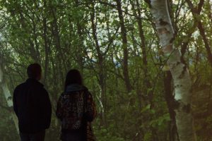
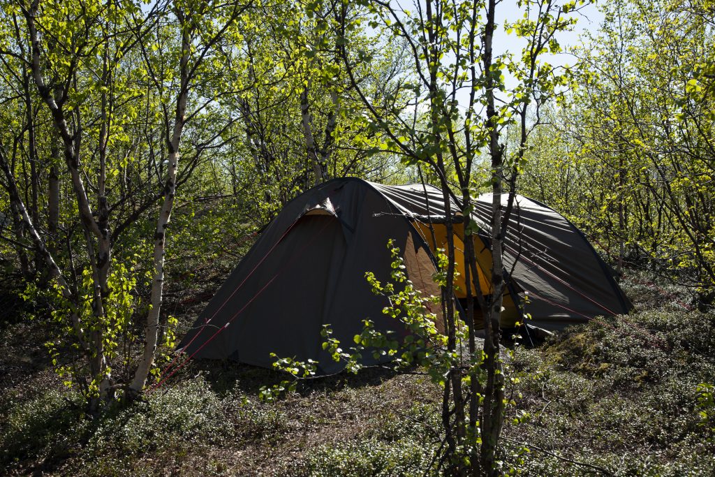
The second of the pair of transits photographed by Tillmans occurred in June 2012, while I was in the process of making Skyvelære #1, alone on the sub-arctic Swedish tundra, my newly established viewpoint. I didn’t repeat Tillmans’ gesture, as heavy rainclouds covered the sky, but I did recognise the desire to do so.
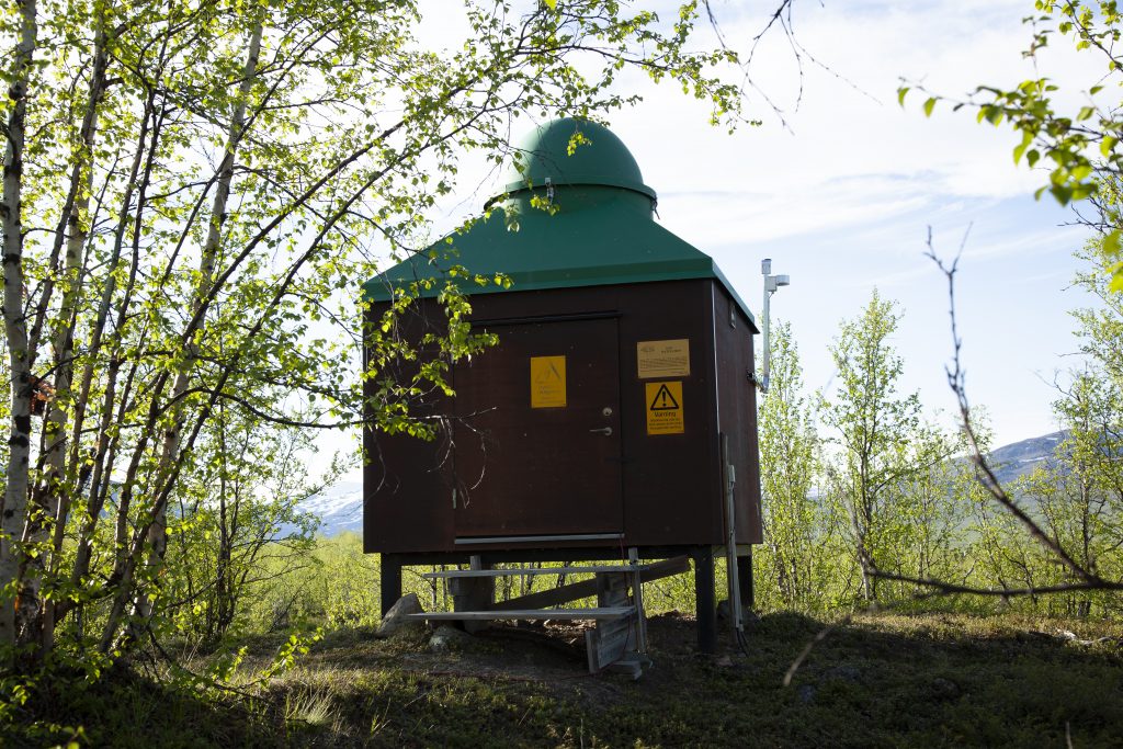
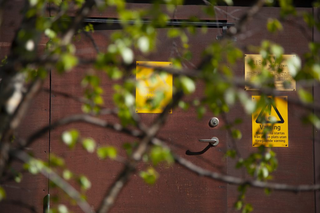
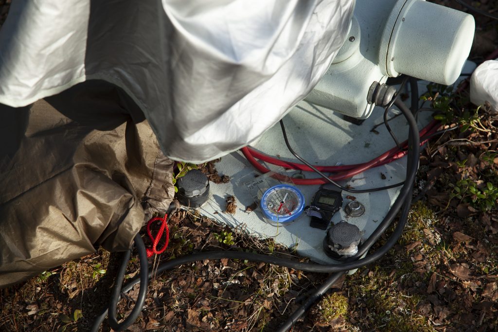
In the Skyvelære exhibition, the tower marks a viewpoint. It indicates how a place or position can be chosen and marked as a specific point. As such it introduces a form of particular geography, where this point is somehow fixed and different from the rest of the world, which might be in movement and flux. While art produces representations that aim to create transitions and transformations, scientific measurements produce quantified representations of the world, extracting bits of information from its never-ending flow. A thermometer in a weather hut, for example, would register the temperature of the air as a discrete number, data (Figure 26). A point can also be such a piece of quantified representation, something defined and discrete representing a snapshot of the continuous.
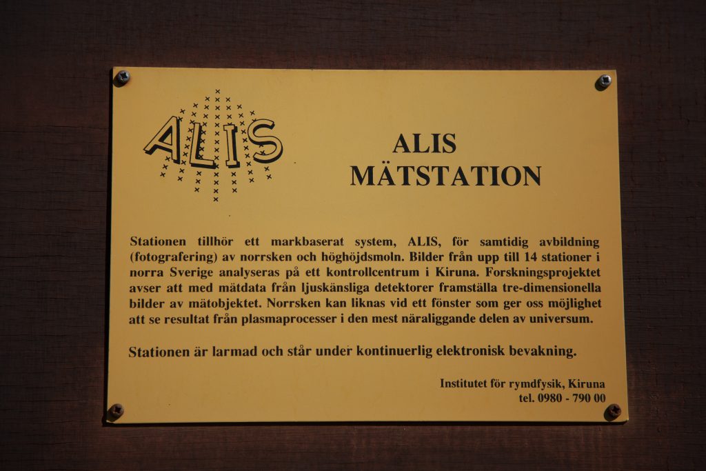
The photos used for the Skyvelære #1 time-lapse were captured from a specific point in the landscape: 67° 51′ 6.7 N, 19° 0′ 12,4 E, 495 masl, which is 65 kilometres from Kiruna, in the north of Sweden. This particular site was established by the Swedish scientist Urban Brändström, who is in charge of the ALIS observatories at theSwedish Institute of Space Physics. As part of his PhD project, The Auroral Large Imaging System (ALIS) (Brändström, 2003), he constructed a ground-based network of automated auroralimaging stations in a grid in northern Sweden. The design, operation and potential scientific results of the system constitute the topics of his thesis. The aim of the system is to simultaneously photograph the Aurora Borealis from different points in the landscape. This is a method that provides him with sequences of data in the form of pictures capturing the same phenomenon at the same time, but from different viewpoints. The main scientific objective of this more complex form of stereographic imaging was to obtain information about the altitude of the observed phenomena in the field of auroral physics by comparing the images from the different viewpoints and determining the 3D spatial structures.
It soon became clear that ALIS had more success in other fields, for example studies of Polar Stratospheric Clouds (Brändström, 2003). The main reason for this appears to be that the resulting data, the sequences of photographs, are often impossible to compare in spite of Brändström having done everything in his power to follow the advice from the Conference Internationale du Passage de Venus in 1881. He has used the same dimensions and types of instruments in order to render observations more comparable. He and his colleagues have also found a solution to the problem of calibrating the image sensors (CCDs) of the cameras (Wang, 2011). What they cannot solve, however, is the problem of cloud formations that vary between different points in the landscape, which, even today, cause problems of comparability.
Prior to going to Sweden in June 2012, I had carried out several projects in Bergen where I had explored the procedure of tracking the sun with the ST-1. When I participated in TheXIth International Pyrheliometer Comparison Event in Davos, I worked alongside John Hickey, the engineering physicist from EPLAB who designed the ST-1. I learned the procedures for how to operate this instrument by watching Hickey attending to the various ST-1s used by most of the countries represented there. Later on, I borrowed one from the Geophysical Institute at the University of Bergen in order to experiment with it. Having observed with great interest the details of the human-device interactions and how the device continuously pointed towards the sun in Davos, I intended to use it as a motorised camera tripod. I much admired the work of video and film artists Michael Snow and Tony Hill, who have invented ingenious devices for creating extraordinary, motorised camera movements that allow the world to be seen from unfamiliar viewpoints. In spite of this, or perhaps because of it, I was not particularly interested in exploring automated camera movements per se. Nor was I convinced that solar tracking time-lapses had any significant potential in the context of my project, being a genre I had mostly encountered in nature documentaries. Rather, I was interested in the procedure of solar tracking and the ST-1 as a device.
In the North of Sweden, the midnight sun offered such a continual presence where the ideal representation could be chased while I explored the various agencies involved in making it. By bringing the tracker to Brändström’s sites in the north of Sweden and applying the procedure there, I also expected to gain further insights as I examined his sites and viewpoints by trying them out for myself.
From two of Brändström’s sites, in Nikkaloukta and Tjautjas the cyclical changes of light and vertical position of the sun demanded recurring adjustments of the devices, which created interruptions and jolts in the otherwise mechanical stream of images These distortions, occurring at irregular intervals, disrupt the impression of continuity and disorient the eye. They may seem to be errors, but, at the same time, they indicate the presence of a person working in the background to capture the discrete data representing the continuous process of the revolving sun. The layer of hands-on adjustment carried out by someone in the semi-automatic procedure is an important part of the work that involves repetitive measuring, aligning and capturing of a sequence of data in the form of images. The presence of this layer of information, which may at first appear to be produced by mistake, reveals my main intention with the piece. It represents the difference between a mode of observation that involves looking at something, which treats the motif as an object and where the observation itself can be transparent and automated, and a mode of observation that involves looking for something, which is a more reflexive process that takes place between the observer, the observed and the resulting representation.
Together, the site, the sun, the tracker, the camera and the operator form a set of relations that must be negotiated in order to construct a representation. The illusion of automatic vision and motion implicit in the time-lapse is repeatedly broken in a rhythm that interferes with and destabilises the experience of the viewer, who needs to reorient his or her gaze, thus destabilising the experience of the film as well.
Tjautjas, a small village 160 km southeast of Kiruna. I came here following my interest in Urban Brändström who I met briefly at the parking lot outside Kiruna Truck, where he handed me a key and a list of coordinates. I had hoped that we could spend some more time together, but as he prepared me to the fact that it wouldn’t be possible, I realized that I wasn’t interested in him after all, but rather in the places he had created; a system of tiny research stations set up in a grid in the open landscape. Reading about his research, I had developed a desire to visit these sites, as if I needed to try them out for myself in order to understand.
This is part of what I do, I explore things by trying them out in different relationships, or by positioning myself in relation to them.